
Communication, Automation, and Intelligence SystemsWe build software, mesh radios, and training simulators for teams operating in challenging environments like emergency response, military domestic operations, and government agencies.Communication and collaboration shouldn't be complicated. Our solutions are practical, tested, and delivered with the experience and quality your mandate demands.[email protected]
TACTICAL INTEROPERABILITY KIT
TIKTAK TRAINING_SYSTEM
Use TIKTAK to track and coordinate TAK peers in a local training environment. Includes pre-configured EUDs (end-user devices) with an optional field-portable TAK Server.TIKTAK allows you to coordinate and train without the overhead of SIM cards, data plans, or complex networking tools.Visualize peers, coordinate navigation training, and track equipment being used in the field. TIKTAK addresses all the above with less than 30 minutes of training.
LONG RANGE, LOW ENERGY COMMUNICATIONS
ACE RADIO_SYSTEM
When infrastructure is out of reach or fails, traditional communications collapse. Teams lose coordination precisely when they need it most.ACE is a battery-efficient, meshing radio system that works without infrastructure. Text messages and GPS positions relay peer-to-peer across extended ranges. No towers. No subscriptions. No internet required.Ruggedized for emergency services, government operations, industrial sites, and remote environments. Ready to deploy in minutes.DevicesACE_MINI $150
Portable text radio with integrated antenna. Battery lasts days, not hours.ACE_PRO $300
Advanced text radio with GPS tracking, enhanced battery, superior antenna, screen and rugged case.ACE_AP $400
Field access point that bridges mesh networks to WiFi devices. Runs for weeks on a single charge.ACE_EDGE $2500
Field server with mapping, message routing, and team coordination tools.Why ACE?- Works completely offline
- Range extends as you add devices
- Open platform—compatible with standard protocols
- Pre-configured and encrypted
- License-free operation
- Canadian built and supportedCoordinate distributed teams, track mobile assets, maintain communications when infrastructure is unavailable or compromised.
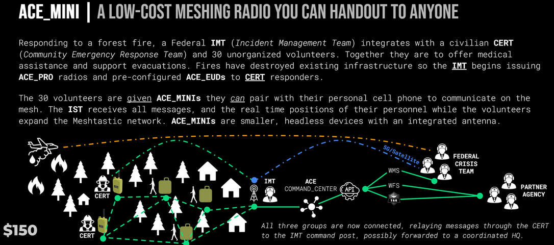
The ACE_MINI, low-cost meshing radio built for mass distribution in an emergency.
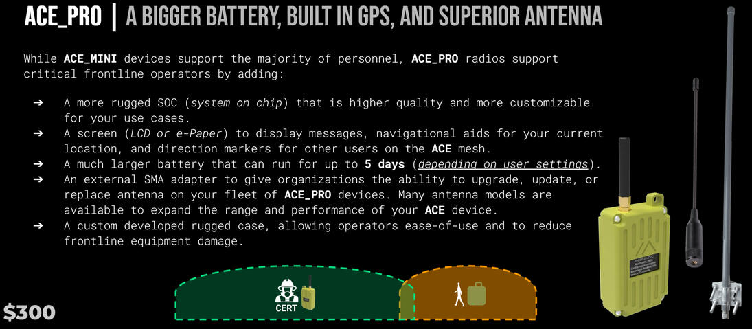
The ACE_PRO, a hardy meshing radio for field operators and vehicles that holds a charge for days and connects you to your mesh.
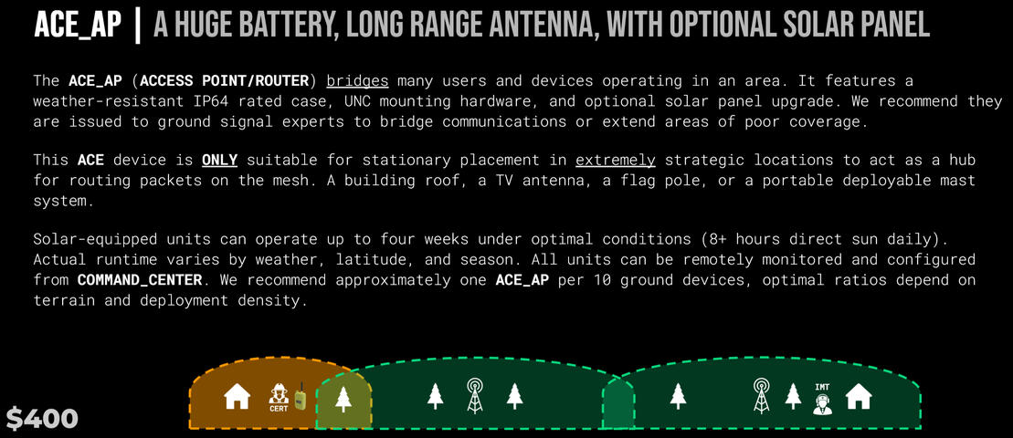
The ACE_AP bridges many users and devices operating in an area. It features a weather-resistant IP64 rated case.
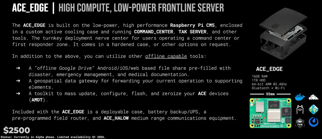
ACE_EDGE is a custom tuned field portable server to run offline, team oriented applications.
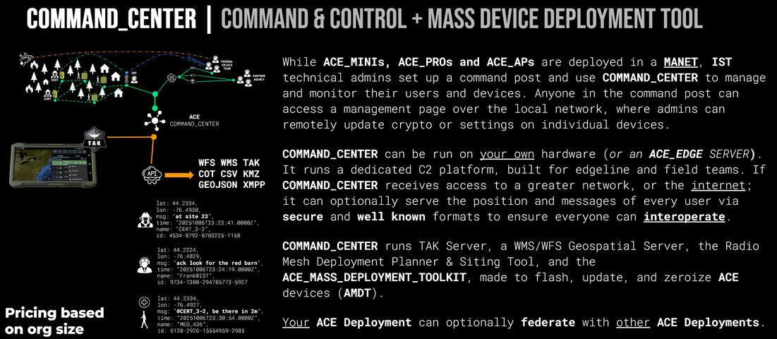
ACE_COMMAND_CENTER is a unified control plane to manage your people, devices, and data feeds.
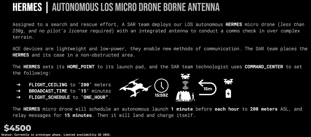
ACE_HERMES is a small, autonomous drone meant to bridge your mesh over a wide area, supporting check-ins and emergency support operations.


SIGNALS INTELLIGENCE TRAINING SIMULATOR
SPECTRA RF_TRAINER
SPECTRA is a training simulator for radio direction finding. Practice locating transmitters without real-world exercising or RF equipment.How It WorksInstructors create scenarios with mobile emitters, and collectors. Students receive data feeds, with controls for educators to scale complexity and difficulty as the simulation progresses.Multiple users can train simultaneously and conduct analysis on this data, using it to tighten workflows and develop new training plans.Key Features- Virtual mobile emitters navigating real-world road networks.
- Includes customizable emitters, with a database of existing real-world devices.
- Multi-user training environment.
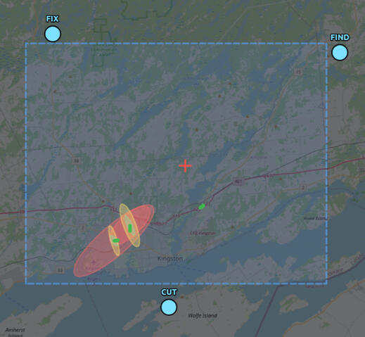
- Visual uncertainty zones for each detection including frequency, emission length, shape, and size.
- Exports live to standard GIS formats (WFS, Esri Shapefile, CSV).
- Pure software—no RF transmissions or hardware required.Build Operational SkillsSPECTRA helps shape the spatial reasoning and coordination skills required for real-world signals intelligence operations. Repeatable, reliable, easy-to-use, and it works offline.
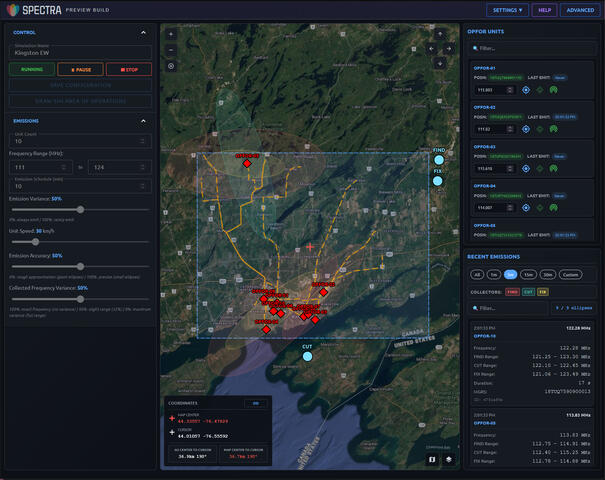
SPECTRA Instructor interface showing a simulation, customized via the many options to the left of the map.
Trainee view allows instructors to toggle or change how outgoing data appears, including GMTI and raw emissions.
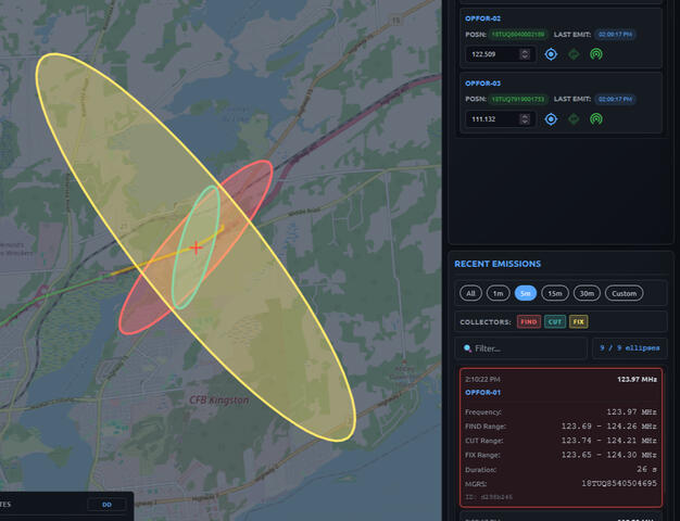
Emissions are dynamically sized, shaped, and oriented toward your placed collectors, preset by the instructor.


Consulting & Custom Software solutions
INTEGRATE AND AUTOMATE
We excel at bridging client requirements to real-world environments.- Human-to-API interfaces
- Geospatial/GIS software solutions
- Trainers, simulators, and automation servers
- GeoINT/Analysis pipelines
© thatcoolsoftware.company